 |
| Detail of the North Mymms Park area of the 1899 OS map of North Mymms Map courtesy of the Royal Library of Scotland |
Maps of south-west North Mymms

Maps of south-east North Mymms
 |
| Detail from the 1898 OS map of North Mymms Map courtesy of the Royal Library of Scotland |
Maps of north-west North Mymms
 |
| Detail of the Colney Heath area of the 1899 OS map of North Mymms Map courtesy of the Royal Library of Scotland |
Maps of north-east North Mymms
 |
| Detail of the Welham Green area of the 1883 OS map of North Mymms Map courtesy of the Royal Library of Scotland |
Bartholomew 'half inch to the mile' maps
 |
| Bartholomew & Sons map of Hertfordshire 1902-1906 Map courtesy of the Royal Library of Scotland |
Maps of the Mimmshall Wood area of North Mymms
 |
| Detail of the 1935 OS map of the Mimmshall Wood area of North Mymms Map courtesy of the Royal Library of Scotland |
Maps of the Roestock area of North Mymms
 |
| Detail of the 1897 OS map of the Roestock area of North Mymms Map courtesy of the Royal Library of Scotland |
These three maps are of the Roestock area of North Mymms. They were produced in 1897, 1924, and 1937.
Maps of the Colney Heath area of North Mymms
 |
| Detail of the 1898 OS map of the Colney Heath area of North Mymms Map courtesy of the Royal Library of Scotland |
Maps of the North Mymms Park area
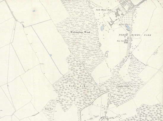 |
| Detail of the 1896 OS map of the North Mymms Park area Map courtesy of the Royal Library of Scotland |
Maps of the Little Heath area of North Mymms
 |
| The 1935 OS map of Little Heath Map courtesy of the Royal Library of Scotland |
Maps of the Bell Bar area of North Mymms
 |
| Detail of the 1898 OS map of the Bell Bar area Map courtesy of the Royal Library of Scotland |
Maps of Brookmans Park Great North Road area
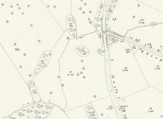 |
| Detail from the 1914 OS map of the east of Brookmans Park Map courtesy of the Royal Library of Scotland |
Maps of Brookmans Park and Water End
 |
| Detail of the 1896 OS map of Brookmans Park and Water End Map courtesy of the Royal Library of Scotland |
Subscribe to:
Posts (Atom)